Karabakh: Geography and Climate of Country

Geography

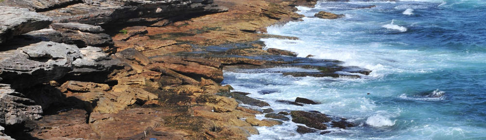
The Nagorno-Karabakh Republic is located in the south-eastern part of the Minor Caucasus. The relief of the republic is typically mountainous; it covers the east part of the Karabakhian upland and goes down obliquely from the west to east. The territory of the Republic is characterized by strongly cut up mountainous relief. The average height above sea level is 1100 m. Almost all the rivers of Nagorny Karabakh, except Araks, flow from the west and south-west mountains to the valley of Artsakh, transforming the relief of the mountainous territory into deep gorges and picturesque valleys. The vastest from them is the valley of the River Tartar in the Martakert region and the valley of Araks in the Lower Karabakh.

From north to south the uplands of Syunik and the mountain ridge of Vardenis stretch out all along the western border of the Nagorny Karabakh, giving birth to some branches of the range, which stretch from west to the east part of the territory.

By the northern side stretches out the Mrov Ridge, on which the highest mountain tops Gomshasar (3724m) and Mrov (3343m) are located. The Karabakhian ridge is composed of the mountain tops Forty Girls (in arm. “Qarasun Aghjikner”)(2828m), Big Kirs (in arm. “Mets Qirs”)(2725m) and Dizapayt (2480m). Big Kirs is located at the place of the junction of the regions of Shoushi and Hadrout, and Dizapayt is in Hadrout region.

Karabakhian upland, like the whole Armenian upland, is characterized by its active seismicity. There is a great amount of plutonites appeared in the ancient times, such as limestone, some other types of sediments referring to the Jurassic and Cretaceous periods.

Climate

Climate in the Nagorno-Karabakh Republic is mild and temperate, close to dry subtropical. Annual average temperature is +10.5 degrees centigrade. The hottest months are July and August, when the average temperature is about 22 degrees centigrade.

Zones of Lower Karabakh are distinguished with relatively high temperature. During the cold period, in the months of January and February, the average temperature in the region fluctuates between -0.2 to -0.9 degrees centigrade.

On the territory of the republic there aren’t long-term cold or hot weather. The coldest temperature in the lowland doesn’t drop lower than 0-2, on the foothills it drops down to -10 degrees centigrade and between 10-20 degrees centigrade in the highlands. The highest temperature rises up to +40 degrees centigrade in the lowlands and +32-37 degrees centigrade in the highlands. Mountainous-valley winds dominate on the territory of the republic. In spring and winter months there happen thunderstorms. Annual average rainfall fluctuates between 480 and 700 mm depending on the zone. The most part of rain is in May-June and September-October. Torrential rains and hail are common in this period, too.

Natural resources. In the Nagorno-Karabakh Republic there is a number of metals and non-metals, however from the geological-research aspect its territory is relatively little investigated.

Since ancient times in Karabakh there have been discovered coal fields, numerous kinds of metals, particularly zinc, lead, copper, gold, sulphurous pyrites, iron. Artsakh is also rich in non-metals. Particularly, there many fields of marble and Limestone of different colour shades.

There are also deposits of granite, basalt, tufa, limestone on the territory of the republic, as well as deposits of raw materials for the production of cement, graphite, lithographic stone, gypsum, sand and clay of high quality.

Since 2002 in Drmbon mine (Martakert region) gold has been extracted.

The Nagorno-Karabakh Republic is also home to mineral water springs. Some of them have been famous since ancient times. Mineral water springs, situated 16-18 km from Shoushi, at the motorway Goris-Stepanakert, are of especial practical importance. They are rich in iron and are appreciated for their healing properties.  Salubrious mineral springs, mild climate, clean air and clear rivers, forests rich in various fruits, picturesque valleys and waterfalls are the wealth of the Nagorny Karabakh – the perfect place for rest.

This slideshow requires JavaScript.


Karabakh: History of Country

History

The Nagorno-Karabakh Republic  (NKR) is a state formed after collapse of the USSR on the basis of the Nagorno Karabakh Autonomous Region (NKAR), an Armenian national-state  formation in the political map of the USSR, and Shahoumyan Region populated by Armenians.

This slideshow requires JavaScript.

The independence of the Nagorno-Karabakh Republic was declared on September 2, 1991, in accordance with the fundamental norms of international law. From that day on the authorities of the republic successively pursue a policy of maintaining peace and stability in the Caucasus region.

From the earliest times Nagorny Karabakh (self name – Artsakh), situated in the north-east of the Armenian Plateau, has been one of the provinces of historical Armenia, the north-eastern border of which, according to all ancient sources, was the river of Kura. The nature and climate of this mountainous region are conditioned by its favourable geographical location. In the ancient Armenian state of Urartu (VIII-V BC) Artsakh was mentioned as Urtekhe-Urtekhini. In the works of Strabon, Pliny the Elder, Claudius of Ptolemy, Plutarch, Dion Cassius and others it was mentioned that the border of Armenia with the neighboring Albania (Aluank), an ancient state which is conglomerated of multilingual Caucasian mountain tribes, passes along the river of Kura.

After the partition of Armenia between Byzantium and Persia (387), the territory of Eastern Transcaucasia (including Artsakh) passed to Persia. That, however, didn’t influence the ethnic borders of the region: the right bank of the Kura together with Artsakh (Karabakh) continued to remain Armenian-populated. Only in the middle of XVIII century the Turkic nomadic tribes begin penetrating the northern regions of Karabakh. That put the beginning of the long-term wars with Armenian princedoms (Melicdoms). Melicdoms of Nagorny Karabakh ruled by crown appanage princes – melics – managed to reserve an actual sovereignty as well as possess their own armed forces, prince’s armed forces, etc. Bound through hundreds of years to repulse the invasions of the Ottoman Empire forces, the raids of nomadic tribes and detachments of numerous and often hostilely disposed Turkic khans, or perhaps the troops of khans themselves, melicdoms of Artsakh strived for freedom from the authorities of different creed. With that end in view, in XVII-XVIII A.D. Karabakhian melics were carrying on the correspondence with the Russian tsars, and the emperors of Peter I, Catherine II, Pavel I were amongst them.

In 1805, the territory of historical Artsakh, formally named Karabakhian khanate along with the vast regions of the Eastern Transcaucasia, was annexed to the “everlasting rule” of the Russian Empire, that was consolidated by Gyulistan (1813) and Turkmenchie (1828) treaties between Russia and Persia.

The period of peace began and lasted till 1917.

After the collapse of the Russian Empire and formation of independent Republic of Armenia and Democratic Republic of Azerbaijan in 1918-1920, Karabakh was self-governed by Armenian National Council and was recognized by the League of Nations as a disputable territory. However Azerbaijan supported by the command of British forces undertook several feeble attempts to put Karabakh, which considered itself a part of Republic of Armenia, under its supervision.

The establishment of Soviet power in Transcaucasia was attended by the establishment of new political orders. After the declaration of Soviet Azerbaijan in 1920, the Russian troops according to the treaty between Soviet Russia and Republic of Armenia temporarily occupied Mountainous Karabakh until the peaceful solution of the problem.

However, immediately after the establishment of Soviet power in Armenia, the RevCom of Azerbaijan (the revolutionary committee – the main authority of Bolsheviks at that time) declares the recognition of “disputable territories” of Nagorny Karabakh, Zangezur and Nakhichevan as integral parts of Armenia. Age at declaring of waiver of claims to Karabakh, Zangezur and Nakhichevan these territories weren’t parts of Republic of Azerbaijan.

On the basis of Soviet Azerbaijan waiver of claims to “disputable territories” and on the basis of agreement between Armenia and Azerbaijan in June 1921, Armenia declared Nagorny Karabakh as its integral part.

Soon, however, the Bolshevist leaders of Russia in the scope of supporting the policy on “world communist revolution”, under which Turkey was assigned a part of “a revolution flame in the East”, changes its position to ethnically kindred Azerbaijan and to the problem of “disputable territories”, and to Nagorny Karabakh as well.

Plenary session of Caucasian Bureau of CPR by ignoring the resolution of the League of Nations and rejecting the plebiscite as democratic mechanism of establishing borders between Armenia and Azerbaijan in 1921, under immediate pressure of Stalin and despite of completed act of cession, and with procedural violations passes a decision on seizure of Nagorny Karabakh from Armenia and formation of ethnical Armenian autonomy with broad rights on these territories amounting to Azerbaijan SSR.

Moreover, Nagorny Karabakh was disintegrated. On one part of it an Autonomy Region was formed, while the rest was dissolved into ordinary administrative regions of Soviet Azerbaijan, so that to liquidate physical and geographical connection between Armenian Autonomy of Karabakh and Armenian SSR. Thus, the vast majority of the territory recognized by the League of Nations as disputable was openly annexed, and the most part of Nagorny Karabakh (Gyulistan, Kalbajar, Karakhat (Dashkesan), Lachin, Shamkhor and others) remained beyond the autonomy.

Dissatisfied by such a state of affairs the population of Karabakh repeatedly tried to draw the attention of soviet government to the necessity of correcting this mistake and including Karabakh into the composition of Armenian SSR.

In the middle of 1980s there was raised another wave of demands on restoration of the historical justice that resulted in the Declaration of State Independence of the Nagorno-Karabakh Republic in 1991 by the Parliament of the NKR. The declaration of the NKR Independence was formed based on the results of national referendum held on December 10, 1991.

In response, Azerbaijan unleashed a large-scale war. Karabakh army repulsed an aggression and expanded its territory having created a security belt, also called “Liberated Territories” of the historical Armenian lands that surround Karabakh.

In May 1994, NKR and Azerbaijan have signed the armistice treaty that locked in actual borders of the Nagorno-Karabakh Republic.

The armistice treaty continues acting till nowadays.